

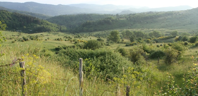
The Nebrodi Mountains (Monti Nebrodi in Italian) are a mountain range, part of the Sicilian Apennines, stretching east to west in the north of the island, comprising the largest protected natural area in Sicily.
The natural landscape of the Nebrodi differs on each of its slopes, but overall its vegetation is very rich and the abundance of water favours the development of flora and fauna, as well as feeding two large artificial lakes: Lake Ancipa and Lake Pozzillo, along with other bodies of water such as Lake Biviere di Cesarò and Lake Maulazzo.
The name “Nebros” comes from the Greek νεβρος, meaning “fawn”, referring to the ancient presence of deer.
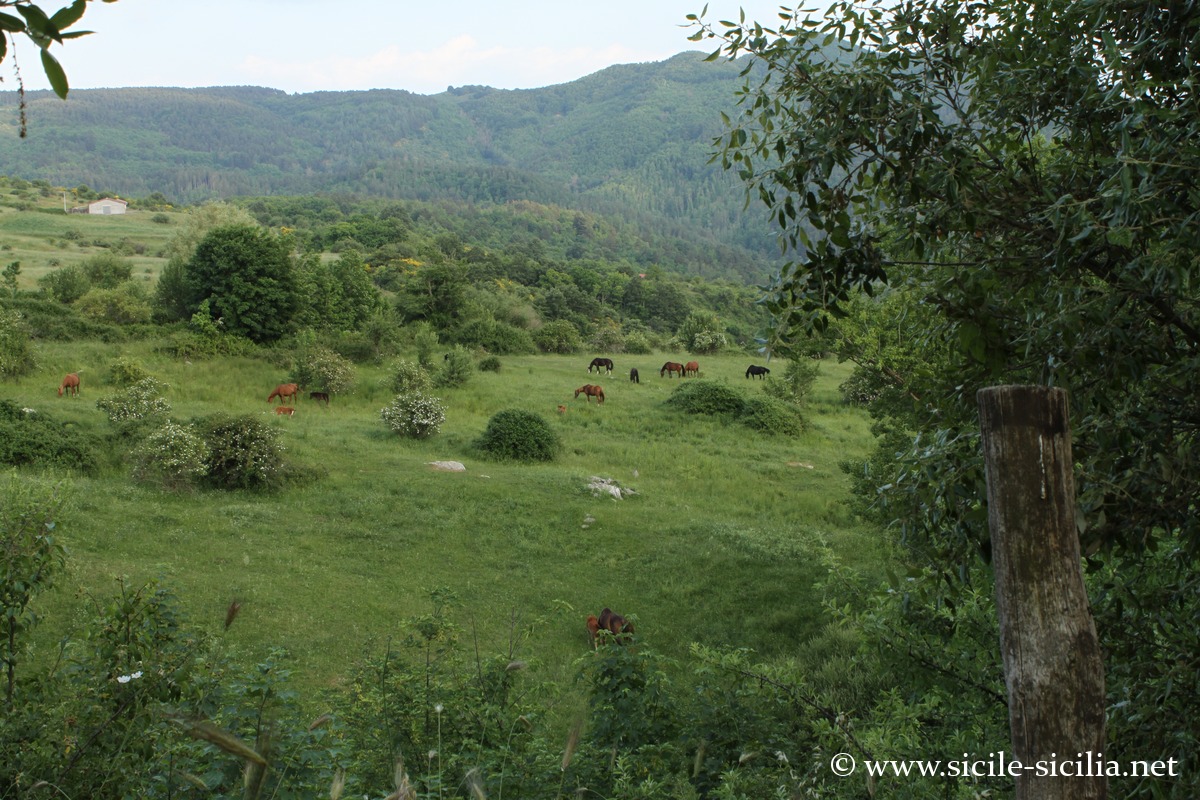
Livestock farming is practised there, partly extensively, especially cattle, but also horses and a native breed of pig, the Black Nebrodi pig (Suino Nero dei Nebrodi), which lives there in a semi-wild state in the woods.
 Show interactive map
A visit to the Nebrodi Park: natural sites and villages
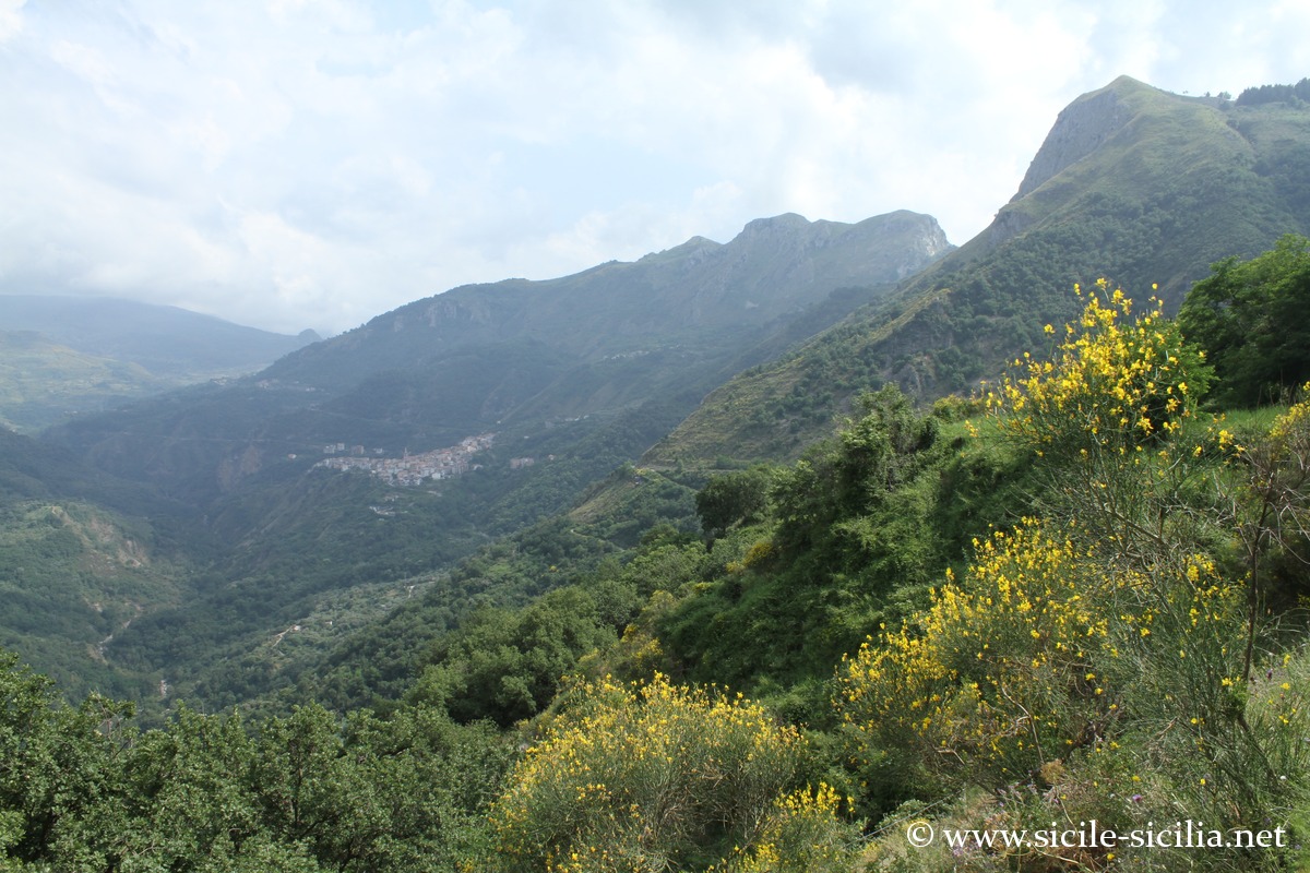
Rocche del Crasto and the Fitalia valley
The Nebrodi Park (Parco Naturale Regionale dei Nebrodi) was established on 4 August 1993 and is the largest nature reserve in Sicily, covering more than 86,000 hectares, with 24 municipalities spread across the provinces of Messina, Catania and Enna.
Natural sites
The park contains 26 different types of natural habitat, home to 38 protected plant species and 84 protected animal species, including golden eagles around the Rocche del Crasto.
The woods covering the mountains over nearly 50,000 hectares make up a good part of the park and are among the largest in Sicily, with beech trees on the southern slopes, various species of oak, including cork oaks and holm oaks, yews, etc.
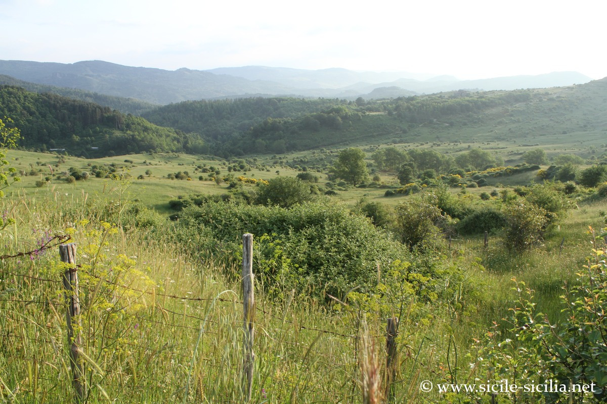
Interior of the Nebrodi towards Floresta
There are numerous remarkable natural sites such as Mount Soro (which peaks at 1,847 metres) with its beech forests and free-roaming horses, Lake Ancipa, Lago Biviere di Cesarò and its stretches of clear water, the Mangalaviti wood, or the high-altitude body of water of Lake Maulazzo.
On the steep slopes of the Rocche del Crasto at 1,315 metres, a limestone massif from the Mesozoic era, live the golden eagle and the great vulture (griffon). This area is suitable for climbing and hiking. One of its natural sites is the Grotta del Lauro, located at 1,068 metres with its many stalactites and stalagmites.
The Catafurco waterfall is one of the most beautiful sites in the park, with a drop of around 30 metres, at the foot of which the waters form the Marmitta dei Giganti (Giant’s Cauldron) in the rock.
Villages and human heritage
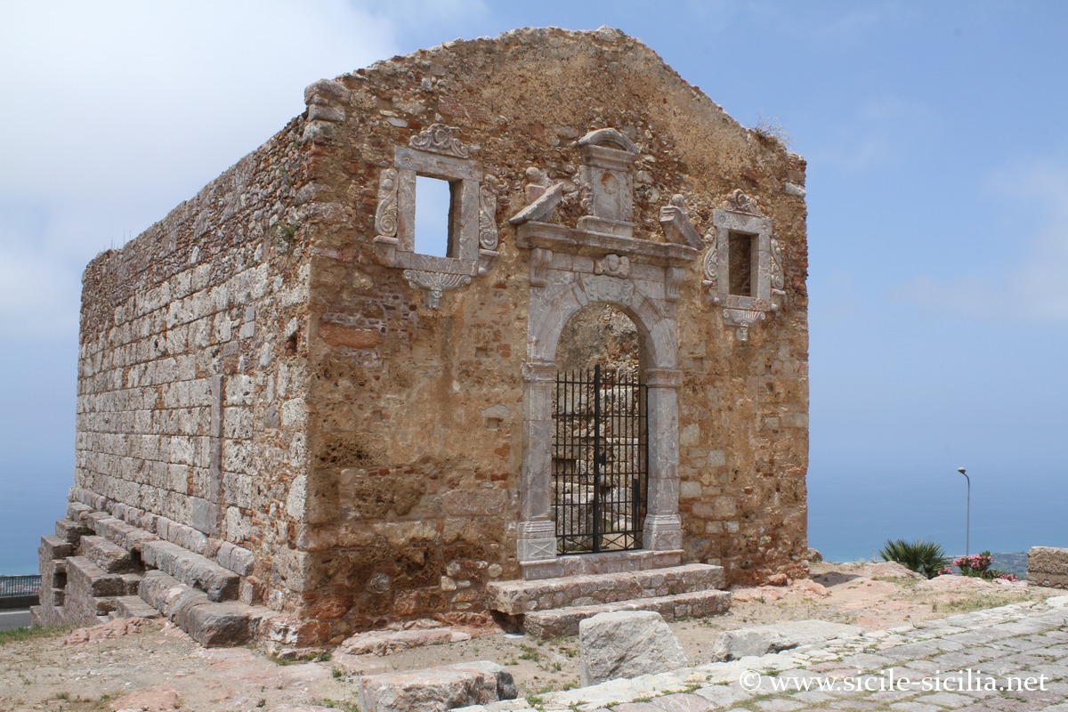
San Marco d’Alunzio
The human heritage can be found in the many castles, villages, churches and prehistoric sites across the 24 municipalities, mostly in the province of Messina.
Two villages are classified among the most beautiful villages in Italy: San Marco d’Alunzio and Troina, which was the first Norman capital of the island.
In San Marco d’Alunzio one can see the traces of several civilisations, including the Greeks with the remains of the Temple of Hercules from the 4th century BCE, or the ruins of the Norman castle, the medieval alleyways, the palaces and the many Baroque churches. Its museum is dedicated to Byzantine and Norman art. The village also offers views of the Aeolian Islands.
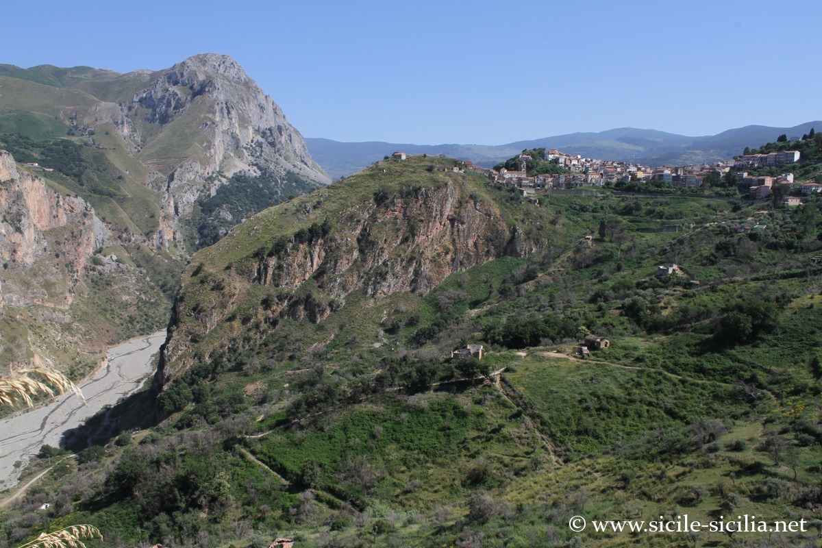
Militello Rosmarino
Among other characteristic villages near the park that are worth a visit are: Montalbano Elicona, a crowned medieval town with its imposing castle; Floresta, the highest village in Sicily, renowned for the production of Provola dei Nebrodi; Galati Mamertino; Longi; Mirto; San Fratello (with its rich cultural and dialectal heritage); and Mistretta, often considered the historic “capital” of the Nebrodi.
The region is well suited to nature and sports activities, such as hiking, climbing, canyoning, and visits to caves including the Grotta del Lauro or the Cave of San Teodoro, which preserves evidence of extinct animals and prehistoric man.
North and west slope (province of Messina – Tyrrhenian side)
- Mistretta: Medieval historic centre, Santa Lucia Cathedral, Regional Museum of Traditions, Starting point for hikes
- Santo Stefano di Camastra: Sicilian capital of artistic ceramics, Museums and craft workshops, Close to sea + mountains
- Caronia: Fortified medieval village, Norman castle, Dominant view over the coast
- San Marco d’Alunzio: Classified among I Borghi più belli d’Italia, remains of the Temple of Hercules (4th century BCE), ruins of the Norman castle, many churches and medieval alleyways, panorama over the sea and the Aeolian Islands
Heart of the massif (central forest area)
- Longi: Ideal base for Rocche del Crasto (see the valleys upstream of San Marco d’Alunzio).
- Galati Mamertino: Religious architecture, Living pastoral tradition (see the valleys upstream of San Marco d’Alunzio).
- Ucria: Small authentic village, Preserved natural environment
- Raccuja: Medieval castle, Compact historic centre
- Floresta: Highest municipality in Sicily (~1275 m), Production of provola dei Nebrodi, Forests and high-altitude pastures
South slope, towards Etna
- Nicosia: Medieval architecture, Norman cathedral, Pivotal position between Nebrodi and Enna
- Sperlinga: Exceptional rock-hewn castle, Troglodytic settlement, Spectacular rocky landscape
- Troina: First Norman capital of Sicily (11th century), Norman cathedral, Strategic position on a ridge
- San Teodoro: Panorama over Etna, Access to the high plateaus of the Nebrodi
- Cesarò: Access to Lago Biviere, Forest and pastoral landscapes
Towards the east
Gastronomy and traditions in the Nebrodi
The region is known for its black pig raised in semi-freedom and several cheeses such as canastrato, maiorchino, ricotta, Provola dei Nebrodi and pecorino.
The Nebrodi also produce Bronte pistachios, olive oil, honey and hazelnuts, forest products such as wild mushrooms (notably porcini), red berries, and artisanal preserves of tomatoes, aubergines and other vegetables.
Local cuisine includes ancient traditional dishes such as handmade maccheroni, charcoal-grilled castrato, and oven-baked capretto.
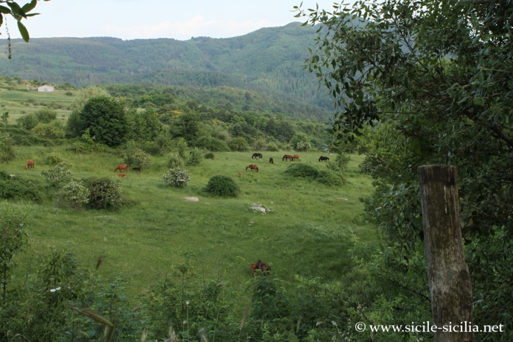

Livestock farming in the Nebrodi
Where the Nebrodi are located: map
If you see this after your page is loaded completely, leafletJS files are missing.
Information
Sources and external sites
- Wikipedia page on the Nebrodi (in Italian).
- Visit Sicily – Nebrodi Park (official page, tourist guide) – general tourist presentation, points of interest, nature, flora and fauna.
- Parco Naturale dei Nebrodi (official site) – park website with practical info, itineraries, contacts and news from the protected area.
- Italia.it – Parco dei Nebrodi (official Italian tourism guide) – page from an Italian institutional guide
Articles: Nebrodi mountains
- Sperlinga
 Sperlinga, a few kilometres from Nicosia, is a picturesque small town that stands out for its old castle half-carved into the rock that dominates the village. Listed among the association ...
 - Nicosia
 Nicosia is a pretty little town often wrongly overlooked by travellers, situated at the foot of the Nebrodi Mountains at over 700 metres of altitude in a valley in the ...
Comments in other languages
To visit the Nebrodi, there’s one thing not to forget: the central areas (Monte Soro, Maulazzo or Mangalaviti) are not very accessible without a car, with little public transport between the villages.
For hikes, you may come across extensive livestock farms with shepherd dogs, such as the Maremmano, the Italian Patou, and no less easy to deal with: a big, sturdy dog with thick white fur, a large head, and a watchful look that leaves no doubt about its job!